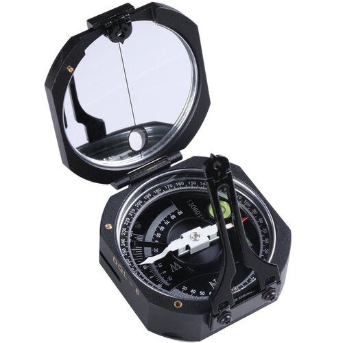
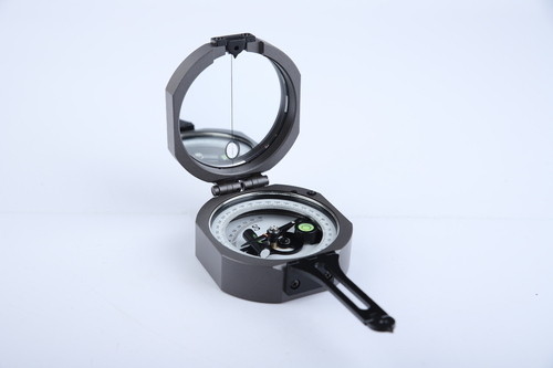
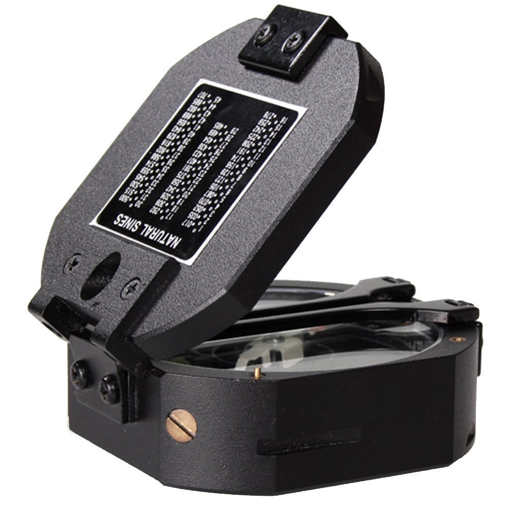
About Geological Compass
The Geological Compass Model DQL-8 is a top choice for professionals in geological surveying and fieldwork. Designed to offer precision and durability, this compass is equipped with features like a graduated dial, clinometer, and sighting device. Its lightweight and rugged design make it perfect for field use in various terrains. The DQL-8 is an essential tool for geologists, mining engineers, and environmental scientists who require accurate and dependable measurements for their work.
Specifications:
- Model: Harbin DQL-8
- Compass Type: Geological Compass
- Graduation: 1 divisions
- Measurement Accuracy: i0.5
- Clinometer Range: 0 - 90
- Dial Material: High-strength glass for clear visibility and durability
- Magnetic Needle Damping Time: i 5 seconds
- Dimensions: 75mm x 75mm x 45mm (approx.)
- Weight: 250g (approx.)
- Case Material: Rugged metal for protection in field conditions
- Sighting System: Precision sighting system for accurate alignment
- Carrying Case: Comes with a protective carrying case
- Applications: Geological surveying, mining exploration, environmental science, forestry, field geology
Harbin Geological Compass, DQL-8 Compass, Geological Surveying Instrument, Field Compass for Geologists, Compass for Geological Studies, Geological Compass for Sale, Geology Field Equipment, Geological Survey Tools, Harbin DQL-8, Geological Compass India.
Built for Rugged Field UseDesigned with a tough stainless steel and aluminium alloy body, this compass is built to withstand the demanding environments encountered during outdoor geological, archaeological, and mining surveys. Its corrosion-resistant finish and included protective carrying case add an extra layer of reliability and convenience for field professionals.
High Accuracy and Versatile ApplicationsThe circular dial, marked in 1 increments, allows for precise angle measurement across a full 360 range. An adjustable sighting viewer and a built-in bubble level enhance accuracy further, making this compass indispensable for tasks requiring exact orientation and alignment in geology, engineering, and related fields.
Ease of Use and Reliable PerformanceOperating this geological compass is straightforward thanks to its needle lock mechanism and clear graduation markings. It provides consistent, reliable readings, and the ergonomic design ensures comfortable handling during extended fieldwork.
FAQ's of Geological Compass:
Q: How do you use the adjustable sighting viewer on the Geological Compass?
A: To use the adjustable sighting viewer, align it with your target or measurement object. Adjust for a clear view, then read the angle on the circular dial to obtain precise directional data. The sighting viewer enhances accuracy for geological and field measurements.
Q: What benefits does the built-in bubble level provide during field surveys?
A: The built-in bubble level ensures your compass remains perfectly horizontal, allowing for the most accurate readings possible. This is essential for reducing measurement errors, especially when conducting geological surveys in uneven or rugged terrain.
Q: When should the needle lock mechanism be engaged?
A: Engage the needle lock mechanism when transporting the compass or when readings are not being taken. This protects the high accuracy magnetic needle from damage and maintains calibration, ensuring optimal performance over time.
Q: Where can this Geological Compass be used effectively?
A: This compass is ideal for geology, mining, archaeology, and engineering surveys in diverse environments. Its robust, corrosion-resistant construction allows it to perform reliably in challenging field conditions such as forests, deserts, rocky terrains, and excavation sites.
Q: What is the process for taking a bearing with this compass?
A: Open the compass, use the built-in bubble level to level the instrument, and align the adjustable sighting viewer with your target. Unlock the needle, allow it to stabilize, then take the reading from the circular dial with marked graduation intervals. Lock the needle after use.
Q: How does the circular dial with 1 graduation improve measurement accuracy?
A: The circular dial with clearly marked 1 graduation intervals allows for highly precise angle measurements. This level of detail supports accurate orientation and direction finding, which is crucial for geological mapping and scientific fieldwork.


 Send Inquiry
 Send SMS