Back to top

Geomax Zenith55 GNSS DGPS Receiver

Geomax Zenith55 GNSS DGPS Receiver

Geomax Zenith55 GNSS DGPS Receiver Specification

  • Application
  • Land Survey
  • Usage
  • Land Survey
  • Material
  • Alloy
  • Color
  • Yellow Grey
  • Product Type
  • DGPS
  • Classification
  • NA


About Geomax Zenith55 GNSS DGPS Receiver

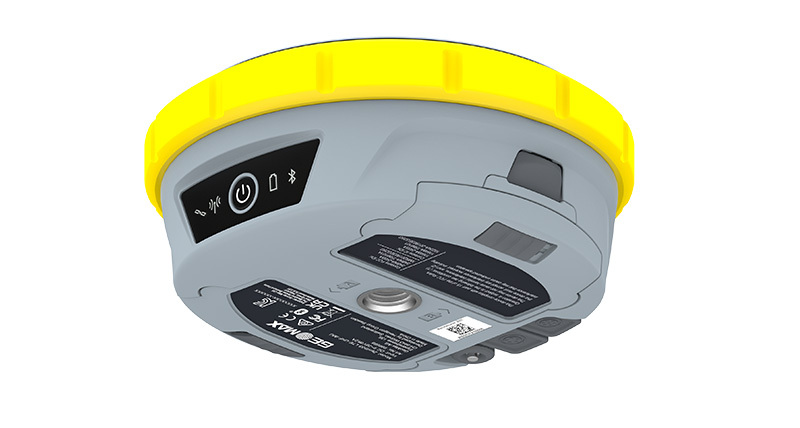
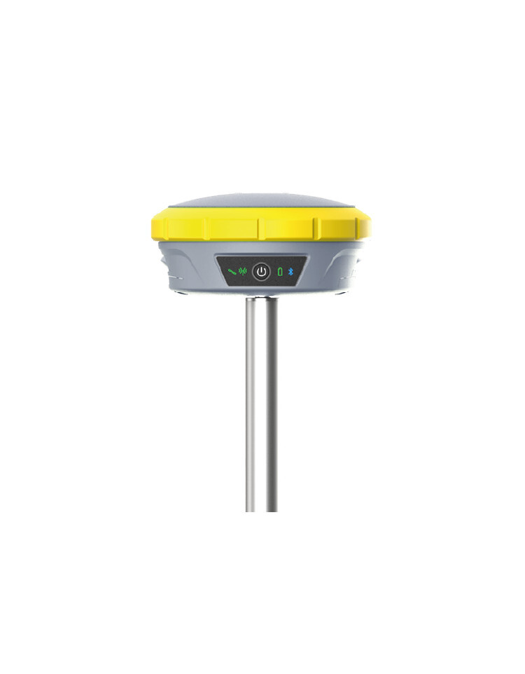
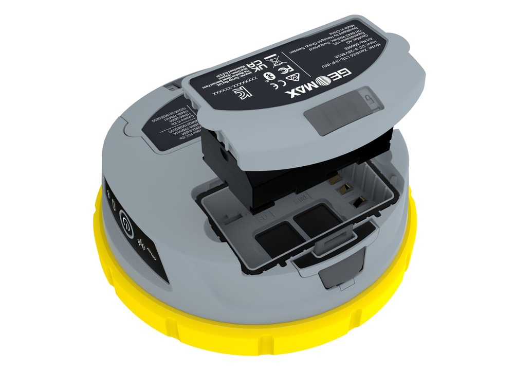
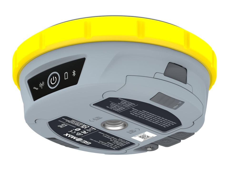
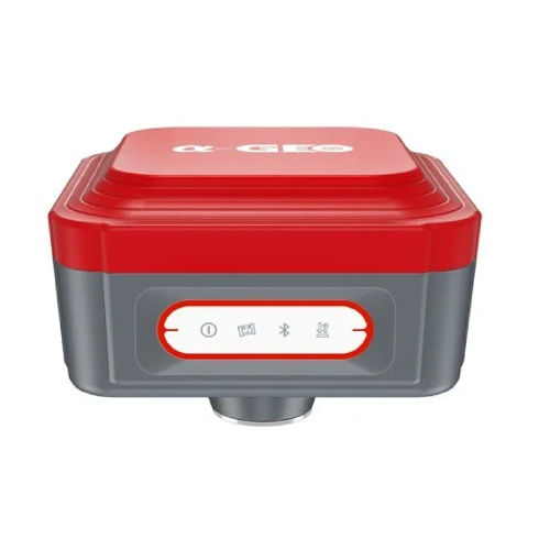
Zenith55 GNSS Receiver HighPrecision Positioning for Surveying GIS Applications


The Zenith55 GNSS Receiver is a cuttingedge highaccuracy Global Navigation Satellite System GNSS receiver designed for land surveying construction and GIS applications Engineered for reliability and efficiency this advanced RTK GNSS receiver supports multiple satellite constellations


Key Features

MultiConstellation Support

HighPrecision RTK Technology Delivers centimeterlevel accuracy for professional applications

Rugged Weatherproof Design Built to withstand harsh field conditions with an IP67rated housing

LongLasting Battery Life Ensures uninterrupted operation for extended fieldwork

Seamless Connectivity Supports Bluetooth WiFi and 4G for realtime data transfer

UserFriendly Interface Easytouse with intuitive software and mobile app compatibility


Applications

Land Surveying Topography

Construction Site Positioning

Geospatial Mapping GIS

Agricultural Land Management

Mining Infrastructure Development


The Zenith55 GNSS Receiver is the perfect choice for survey professionals who demand precision durability and advanced functionality Whether for largescale infrastructure projects or small surveying tasks this receiver ensures highperformance results


Get in touch today for the best price on Zenith55 GNSS Receivers


High-Performance GNSS DGPS Receiver

The Geomax Zenith55 incorporates the latest GNSS receiver technology, allowing surveyors to obtain highly accurate and reliable positioning data. Its design ensures optimal performance, even in challenging environments, making it a top choice for professional land survey applications.


Durable and Ergonomic Construction

Constructed from robust and lightweight alloy, the Zenith55 is built to endure daily use in the field. Its yellow-grey coloration offers excellent visibility, while its ergonomic form factor ensures easy transport and handling during intensive survey work.


Ideal for Land Surveyors

Purpose-built for land surveying, the Geomax Zenith55 seamlessly supports both novice and experienced users. Integrated features streamline workflows, boost productivity, and enable precise data collection, essential for accurate site mapping and boundary definition.

FAQ's of Geomax Zenith55 GNSS DGPS Receiver:


Q: How does the Geomax Zenith55 GNSS DGPS Receiver benefit land surveyors?

A: The Zenith55 receiver provides surveyors with precise and reliable satellite-based positioning, enhancing accuracy for mapping, staking, and boundary delineation. Its robust alloy build and user-friendly features make fieldwork more efficient and dependable.

Q: What materials are used in the construction of the Geomax Zenith55?

A: The receiver is crafted from a high-quality alloy, which delivers a balance of strength, durability, and lightweight performance. This ensures longevity and portability for regular land survey applications.

Q: When is it best to use the Geomax Zenith55 GNSS DGPS Receiver?

A: This receiver is particularly suited for use during any land surveying project where high-precision location data is essential. Its rugged design allows reliable performance in various weather and field conditions.

Q: Where is the Geomax Zenith55 manufactured, and who typically supplies it?

A: The device is manufactured in Sweden and is available through authorized manufacturers, suppliers, and traders specializing in surveying equipment and professional geospatial solutions.

Q: What is the process for setting up the Geomax Zenith55 on-site?

A: Setting up involves mounting the receiver on a suitable surveying pole or tripod, powering it on, connecting to a compatible controller or data logger, and configuring it using the intuitive interface. Once initialized, the unit starts collecting and processing GNSS data for survey work.

Q: How is the Geomax Zenith55 typically used during land survey projects?

A: Surveyors use the Zenith55 to collect high-precision spatial coordinates by connecting it to surveying software and mapping tools. Its fast satellite acquisition and robust signal processing facilitate accurate measurements and efficient progress across various terrain.

Tell us about your requirement
product

Price:

Quantity
Select Unit

  • 50
  • 100
  • 200
  • 250
  • 500
  • 1000+
Additional detail
Mobile number

Email

More Products in Survey Equipment Category

Estwing Hammer Pointed Tip

Estwing Hammer Pointed Tip

Price 4700.00 INR / Piece

Minimum Order Quantity : 1 Piece

Usage : Industrial

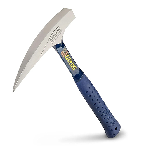
Material : Mild Steel

Operate Method : Manual
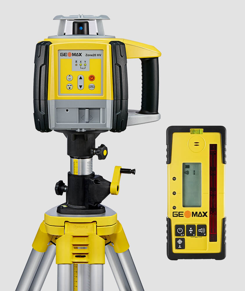
Product Type : Estwing Hammer

GeoPlus Alpha Geo GNSS Receiver

GeoPlus Alpha Geo GNSS Receiver

Price 180000 INR / Piece

Minimum Order Quantity : 1 Piece

Usage : Land Survey

Material : ABS

Operate Method : Digital

Geomax Auto Level

Geomax Auto Level

Price 16500 INR / Unit

Minimum Order Quantity : 1 Unit

Usage : Industrial

Material : MS

Operate Method : Semi Automatic

Product Type : Geomax Auto Level

Geomax Total Station

Geomax Total Station

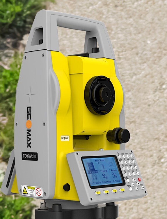
Price 260000 INR / Number

Minimum Order Quantity : 1 Number

Usage : INDUSTARY

Material : Stainless Steel

Product Type : Geomax Total Station